Danlí (Danlí)
Danlí is a city and a municipality in Honduras. It is currently the fourth most populated municipality in Honduras, located approximately 92 kilometers southeast of Tegucigalpa, in the Honduran department of El Paraíso known for its production of cigars and corn (maize). The city is situated at an altitude of 814 meters (2,673 feet) above sea level and has a population of 75,420 (2020 calculation) The population of the municipality (2018) is 214,566 people which is composed of 105,929 men and 108,637 women. With a population in the urban area of 85,075 people and in the rural area of 129,491 people.
The official flower is the napoleón, a type of bougainvillea. The official tree is the jiñicuado (bursera simaruba), which is considered to be so easy to grow that a stake driven into the ground will take root. The official mammal is the howler monkey, an endangered species that inhabits the broad-leaf forests of the Apagüíz and Apapuerta mountains. The region also has pine forests. In general, pine forests are on the north-facing slopes while the broad-leaf forests are on south-facing slopes. Other fauna around Danlí include deer and several species of birds, such as the oropendula, parrot and mynah. Residents of rural areas near Danlí have reported jaguar and quetzal sightings. A landmark is the mountain of Apagüíz, which has a prominent stone outcropping near the summit and is visible from the southern parts of the city.
The official flower is the napoleón, a type of bougainvillea. The official tree is the jiñicuado (bursera simaruba), which is considered to be so easy to grow that a stake driven into the ground will take root. The official mammal is the howler monkey, an endangered species that inhabits the broad-leaf forests of the Apagüíz and Apapuerta mountains. The region also has pine forests. In general, pine forests are on the north-facing slopes while the broad-leaf forests are on south-facing slopes. Other fauna around Danlí include deer and several species of birds, such as the oropendula, parrot and mynah. Residents of rural areas near Danlí have reported jaguar and quetzal sightings. A landmark is the mountain of Apagüíz, which has a prominent stone outcropping near the summit and is visible from the southern parts of the city.
Map - Danlí (Danlí)
Map
Country - Honduras
 |
 |
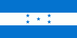
| Flag of Honduras | |
Honduras was home to several important Mesoamerican cultures, most notably the Maya, before the Spanish colonization in the sixteenth century. The Spanish introduced Catholicism and the now predominant Spanish language, along with numerous customs that have blended with the indigenous culture. Honduras became independent in 1821 and has since been a republic, although it has consistently endured much social strife and political instability, and remains one of the poorest countries in the Western Hemisphere. In 1960, the northern part of what was the Mosquito Coast was transferred from Nicaragua to Honduras by the International Court of Justice.
Currency / Language
| ISO | Currency | Symbol | Significant figures |
|---|---|---|---|
| HNL | Honduran lempira | L | 2 |
| ISO | Language |
|---|---|
| ES | Spanish language |


